For the best experience,
view this site on a computer!
 Shop Prints on Etsy
 Custom Cartography
 Portfolio
 Get in Touch
For the best experience,
view this site on a computer!
Shop Prints on Etsy
Custom Cartography
Portfolio
Get in TouchCustom Cartography · Jackson, WY
Explore the world through beautifully crafted, data-driven maps
Start Your Custom Map TodayWhere We Work
Drag, scroll, or click a pin to explore project locations.
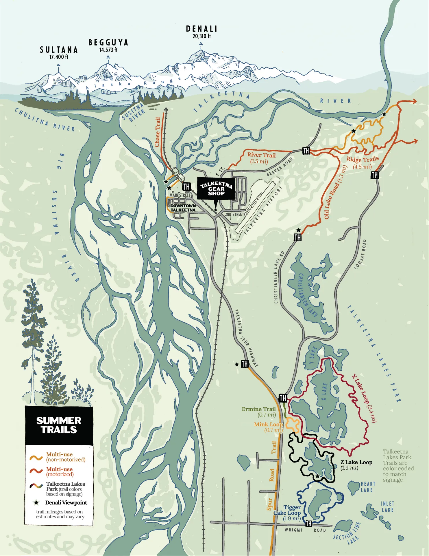
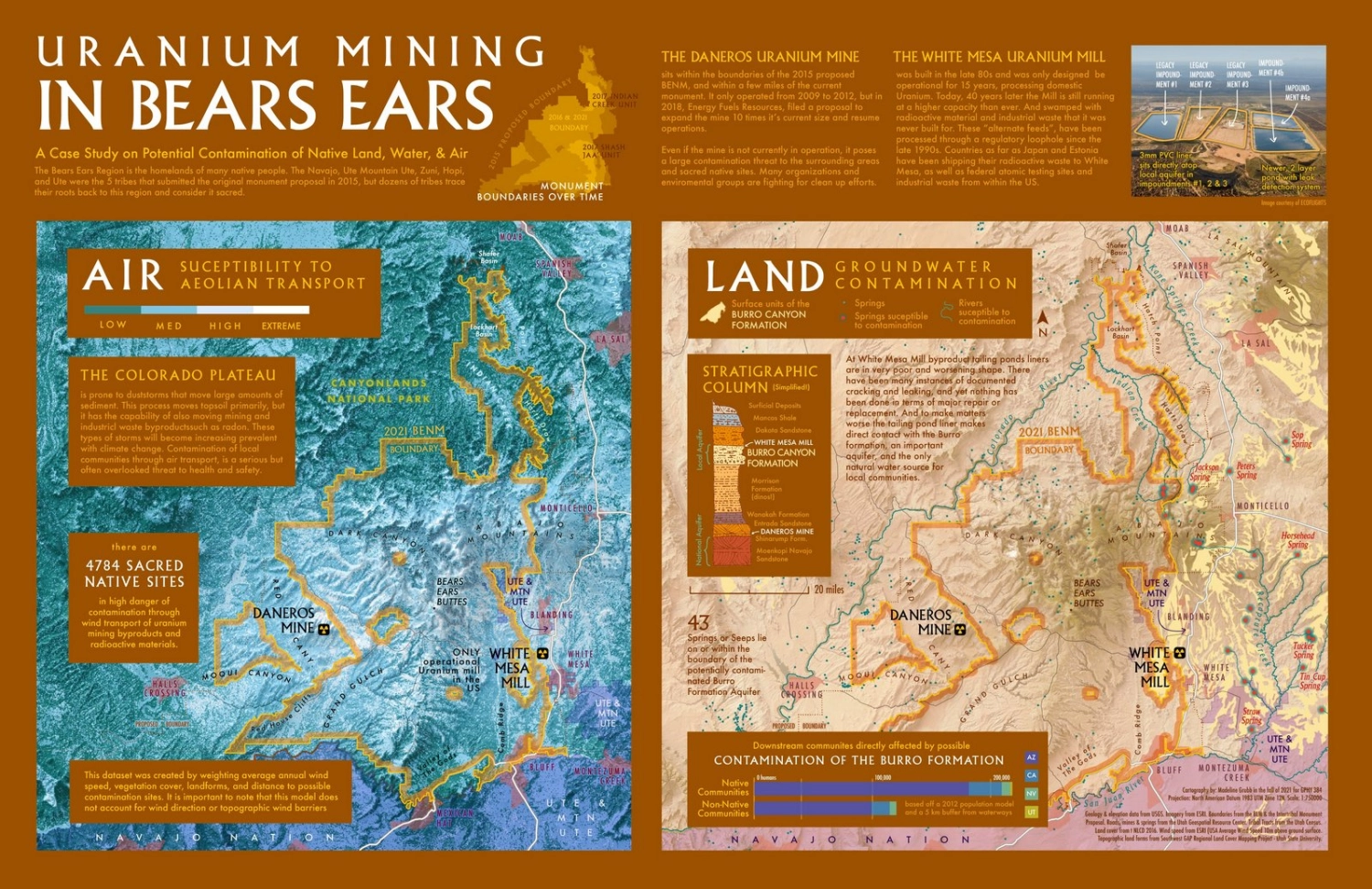
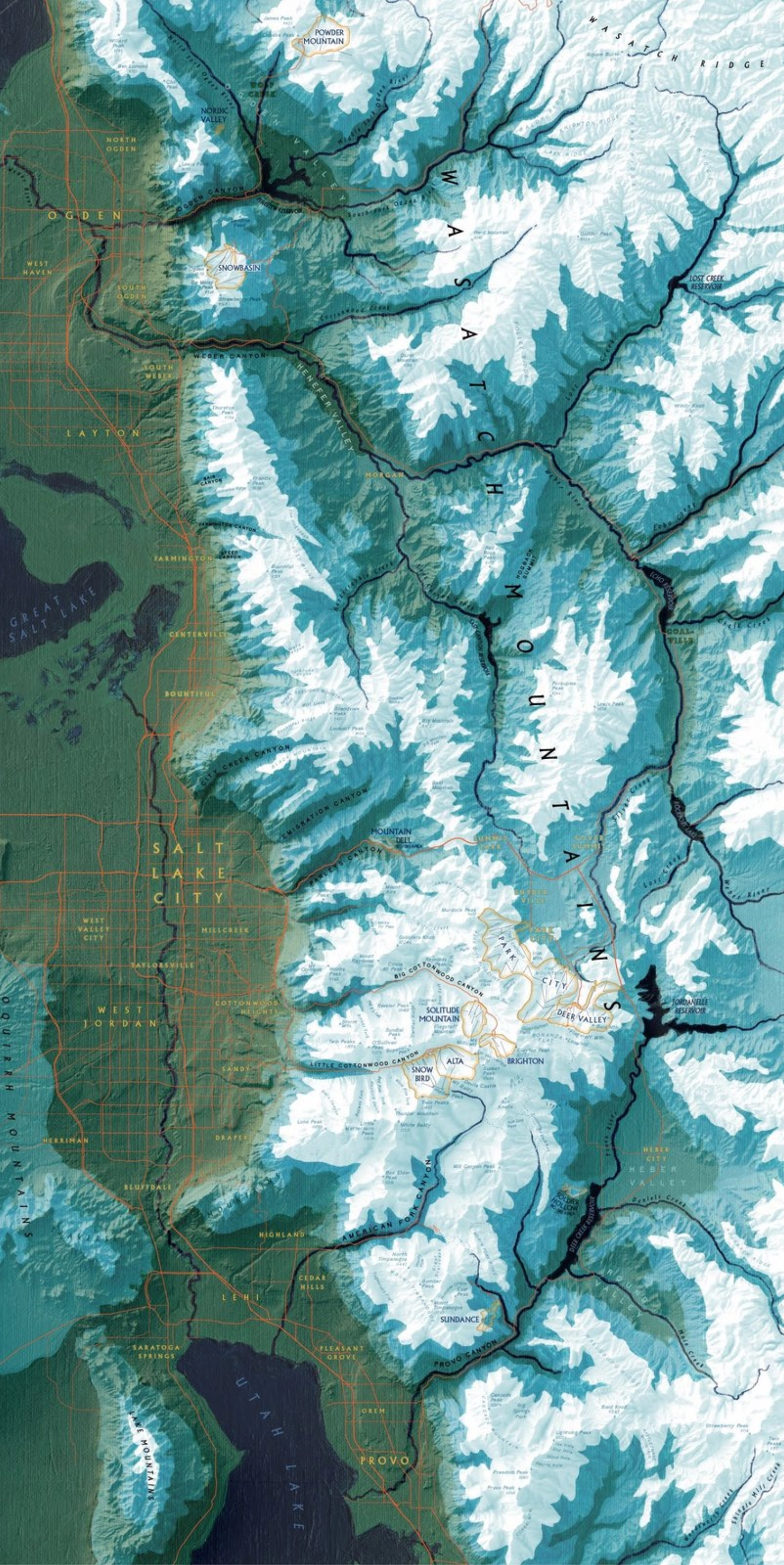
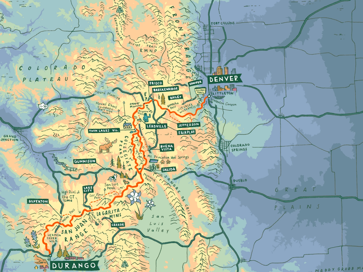
Maps that showcase stunning landscapes, tell stories, aid in navigation, help make decisions, and solve complex spatial problems.
Clients & Partners


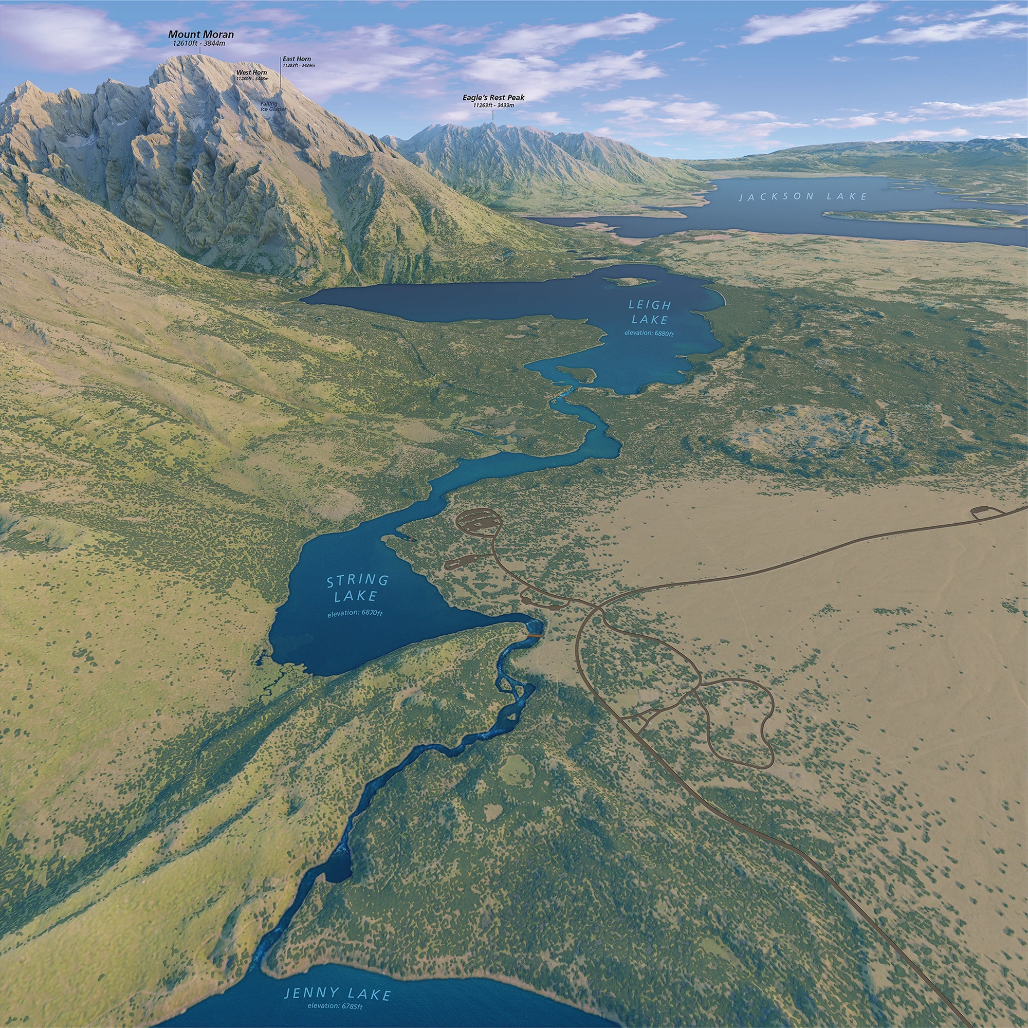
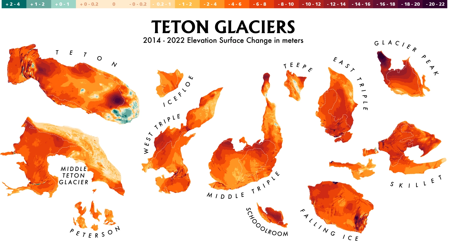
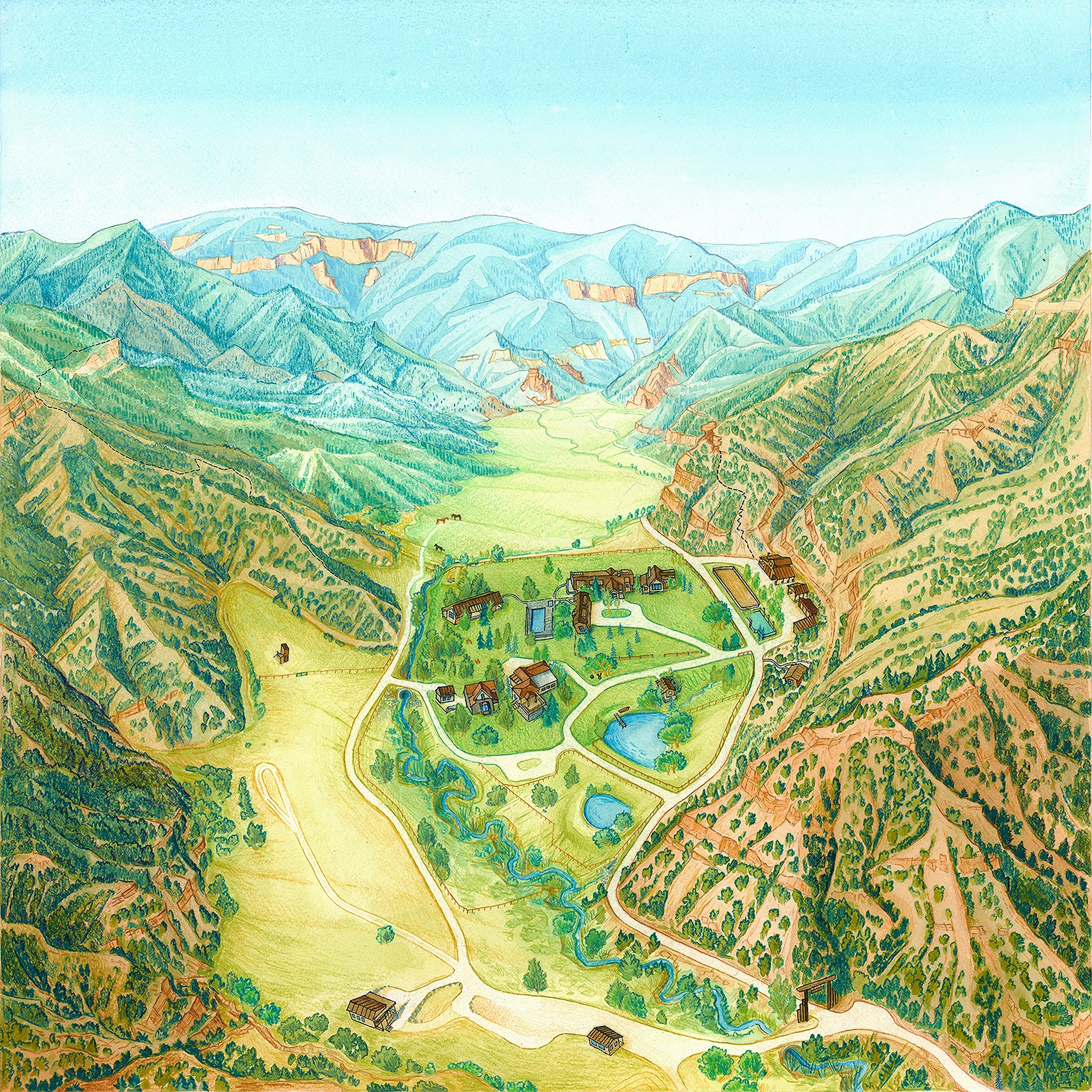
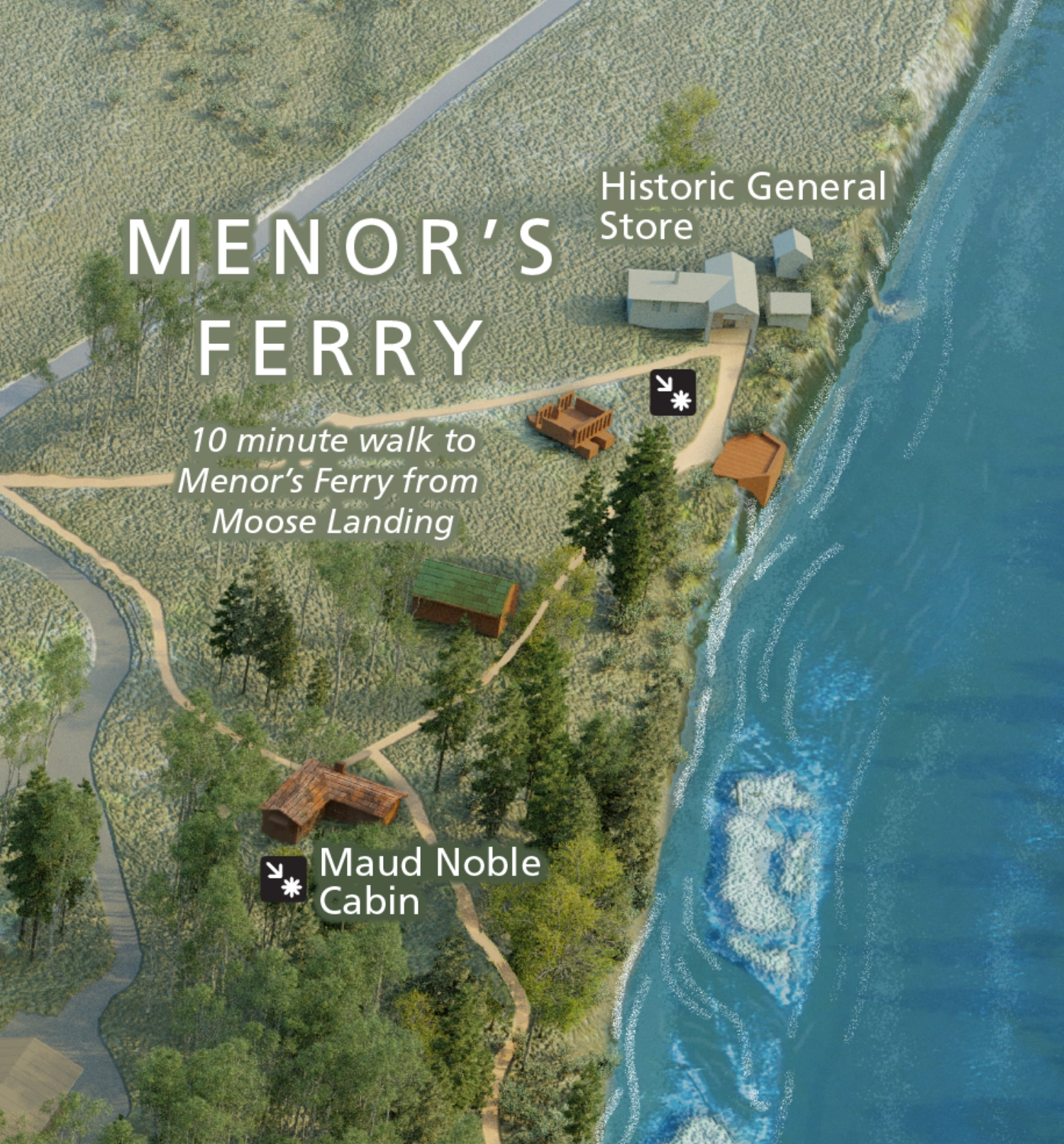
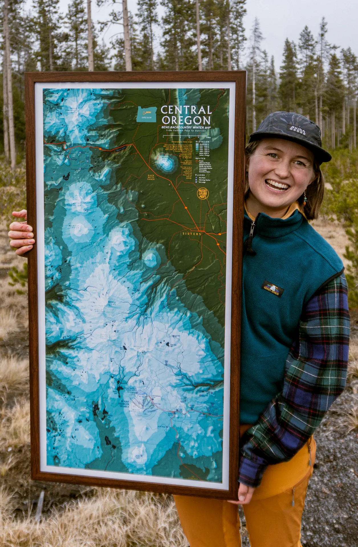
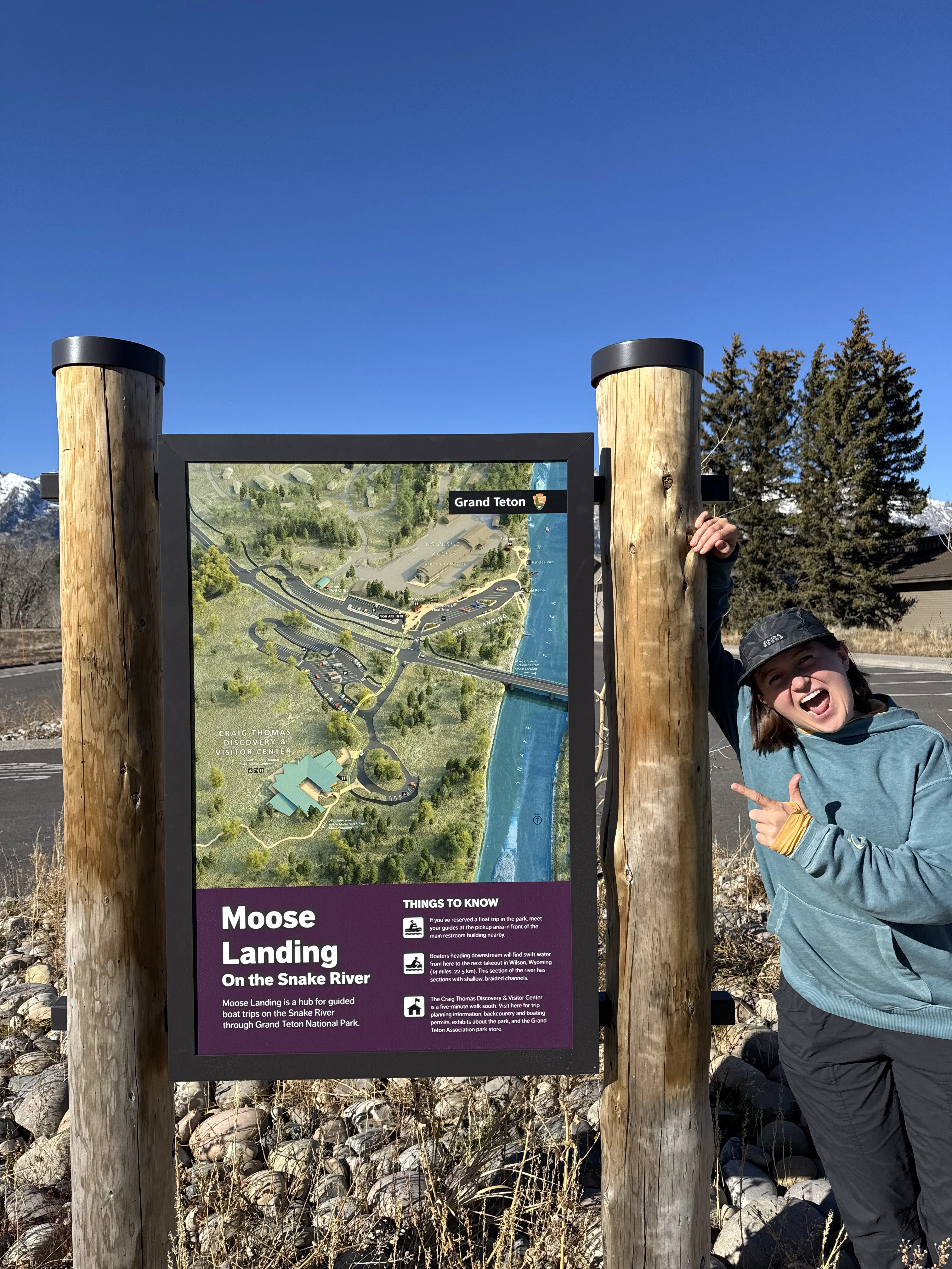
I'm a freelance cartographer based in Jackson, Wyoming, former NPS Cartographic Technician at Grand Teton National Park, thru-hiker, and earth scientist. I create maps that are equal parts scientifically rigorous and visually stunning: photorealistic 3D terrain, hand-drawn watercolor, and GIS-driven analysis for the clients and landscapes that deserve something extraordinary.

Interactive
Explore this interactive 3D model of the Glaciers of Mount Moran. Drag to rotate, scroll to zoom.
Start Your Custom Map Today